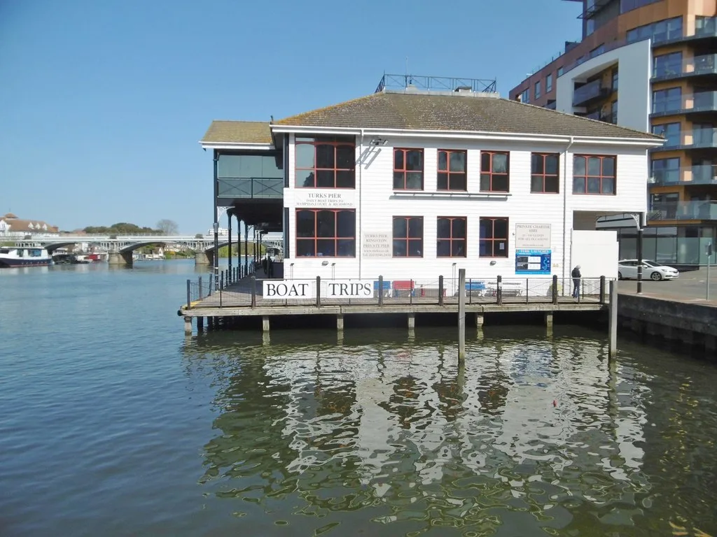

Fenwick wants about 145 homes in blocks of up to 12 storeys by the river north of John Lewis. The draft Local Plan says 95. Final drop-in Saturday 19 September.
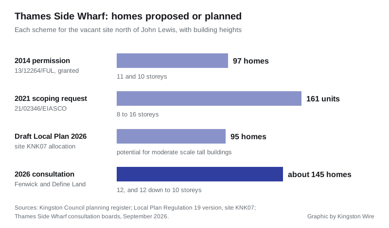
Fenwick has published plans for about 145 homes on Thames Side Wharf, the empty riverside plot north of John Lewis and Waitrose in Kingston town centre. The homes would sit in two buildings of up to 12 storeys.
The scheme is at consultation stage. No planning application has been made yet. The last public drop-in is on Saturday 19 September, 10am to 1pm, at Anstee House, Wood Street, KT1 1TS.
The draft Local Plan the council consulted on this summer expects 95 homes on the same site.
What is proposed
Fenwick owns the site and is working with Define Land as development manager. The scheme is set out on the consultation website and in 11 exhibition boards published this week.
The boards list:
- approximately 145 one, two and three-bedroom homes
- two buildings: the riverside building at 12 storeys, and the eastern building stepping down from 12 to 10 storeys
- a riverside restaurant and other commercial space on the ground floor
- a public riverside space with seating, informal play, a rain garden and room for market stalls
- a shared roof terrace for residents on the 10th and 11th floors
- blue badge parking bays and a loading bay
- all-electric buildings with air source heat pumps and roof-mounted solar panels
The website’s summary says “around 140” homes, while the boards say approximately 145. The final number will only be fixed in a planning application.
The site sits between Vicarage Road and Water Lane, with the Bentall Centre to the east. It is set back from Turks Pier. The architects are Lyons + Sleeman + Hoare, and the planning consultants are DP9.
What the boards do not say
The boards give no figure for affordable housing. They do not say how many homes would be for sale or for rent.
That matters because of the council’s draft Local Plan. Its affordable housing policy lets schemes on private land skip a financial viability test if at least 35 per cent of homes are affordable. Anything below that goes through a viability assessment.
The draft Local Plan says 95 homes
The Regulation 19 version of Kingston’s Local Plan allocates the site as KNK07, on pages 238 and 239. Consultation on it closed on 4 September. The allocation says:
- 95 additional homes, delivered within years 6 to 10 of the plan, which runs from 2028 to 2043
- the site is suitable for “moderate scale Tall Buildings”, which the plan defines as anything over 21 metres
- building heights “should step down towards the River Thames”, avoiding “a wall of development overlooking the river”
- buildings must be set back 16 metres from the river
- development should avoid harm to views from Hampton Court Palace, Market Place, Bushy Park, Kingston Bridge and Richmond Park
The consultation boards put the 12-storey building on the riverside and step the eastern building down away from the river. The boards do not say how this layout fits the draft plan’s step-down guideline. The plan is not yet adopted, and an inspector is due to examine it.
The site has had permission before
This is not the first plan for the wharf. The council’s planning register records two earlier schemes:
- 2014: application 13/12264/FUL, for 97 homes in buildings of 11 and 10 storeys plus a two-storey restaurant, was granted on 17 November 2014. It was never built.
- 2021: a request for an environmental impact scoping opinion, 21/02346/EIASCO, described two buildings of 8 to 16 storeys with 161 units. The council’s scoping opinion was issued on 24 August 2021. A search of the register for the site’s name shows no full application since.
The new boards say only that “previous proposals have not progressed due to a range of constraints”.
Flood risk shapes the site
Most of the wharf is in the Thames floodplain. The council’s Level 2 flood risk assessment for the site, dated September 2024, finds:
- all of the assessed site is in Flood Zone 2
- 60.7 per cent is in Flood Zone 3a
- 23.81 per cent is in Flood Zone 3b, the functional floodplain
Because homes are classed as “more vulnerable”, the scheme will have to pass the flood Exception Test. The assessment says development should be directed away from the western part of the site, nearest the river, with access towards Vicarage Road.
When it could happen
The developers’ timeline on the boards is:
| Stage | Timing |
|---|---|
| Pop-up events at the Bentall Centre | July 2026 |
| Public consultation | Summer 2026 |
| Planning application submitted | Autumn 2026 |
| Council decision | Winter to spring 2027 |
| Construction begins | Winter 2028 |
| Construction completed | 2030 |
What it means for you
- To see the plans in person, go to the drop-in at Anstee House, Wood Street, on Saturday 19 September between 10am and 1pm. The first session was on Tuesday 15 September.
- To comment now, use the survey on the consultation website. Comments at this stage go to the developers, not the council.
- For questions, the consultation team is on ThamesSideWharf@kandaconsulting.co.uk or 020 3900 3676.
- Your formal say comes later. Once an application is lodged, anyone can comment to the council through its planning register. We track new applications on our Kingston planning page.
Sources
- Thames Side Wharf consultation website and exhibition boards, September 2026, Fenwick and Define Land.
- Kingston Local Plan, Regulation 19 publication version, site allocation KNK07 and policies KD9 and KH2.
- Royal Borough of Kingston upon Thames, Strategic Flood Risk Assessment Level 2, site KNK07, September 2024.
- Kingston Council planning register, applications 13/12264/FUL and 21/02346/EIASCO.
Have your say