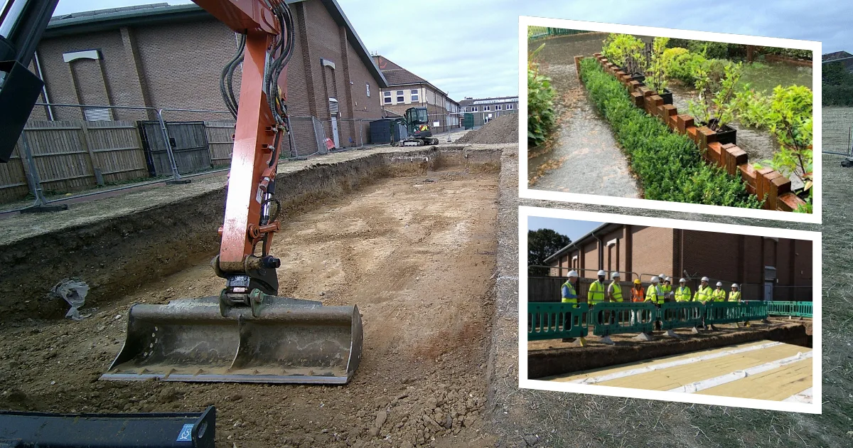

An underground flood store now sits under Coombe Girls' School's playing field in New Malden, built over the summer. A second phase follows in summer 2027.
An underground flood storage system has been built beneath the playing field at Coombe Girls’ School in New Malden. It is designed to protect the school and the roads and homes around it from heavy rain.
Kingston Council announced on 1 October that the first phase is complete. The work was done during the summer holidays.
What has been built
The council says the system will “collect and dissipate excess water effectively”. It is aimed at surface water and storm water, the kind of flooding that happens when rain falls faster than drains can take it.
- Phase one: underground storage and drainage under the school playing field, finished this summer.
- Phase two: similar infrastructure on the north-west side of the school, planned for next summer.
The school is on Clarence Avenue, KT3. The council has not published the cost, how much water the system holds, or how many homes it protects.
Councillor Mike Massimi, portfolio holder for climate action, biodiversity and regulatory services, said the council needed “to plan for the worst while aiming for the best”. He added: “Flood resilience is a shared responsibility, and there’s lots that people can do in their own lives to help.”
Why New Malden
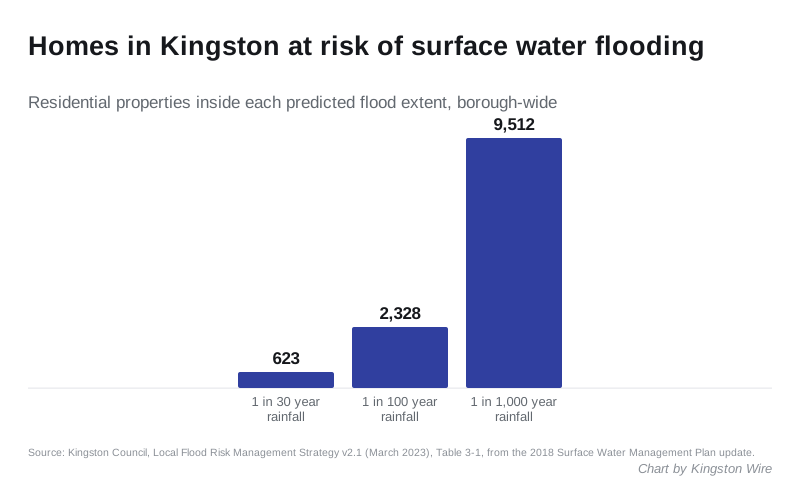
New Malden is one of the three parts of the borough most at risk of surface water flooding. The other two are Kingston town centre and Hook. That ranking comes from the council’s own Local Flood Risk Management Strategy, published in March 2023.
The same strategy counts the homes at risk across the borough:
| Rainfall event | Homes at risk |
|---|---|
| A 1 in 30 year storm | 623 |
| A 1 in 100 year storm | 2,328 |
| A 1 in 1,000 year storm | 9,512 |
A home counts as at risk if water would reach at least 150mm deep beside it, roughly doorstep height. The figures come from a 2018 update of the borough’s surface water modelling, and cover the whole borough, not New Malden alone.
The second scheme in a year
The council calls this its second major flood project in 12 months. The first was a flood basin at the Sir Francis Barker recreation ground in Chessington, completed in autumn 2025.
The council said then that more than 600 homes in the Hook area were at some risk of flooding. That basin:
- holds up to 450,000 litres of rainwater before releasing it slowly into the Thames Water system
- needed 720 tons of earth dug out, most of it reused on site
- added 160 metres of new drainage
- is not a permanent pond and fills to a maximum of one metre
Smaller schemes have also been finished elsewhere in the borough:
- four new rain gardens along Lower Ham Road and King Charles Road
- a new sustainable drainage system on Richmond Road
A rain garden is a shallow planted bed that catches run-off from the road and lets it soak away slowly.
What it means for you
If you live near Coombe Girls’ School, the scheme is meant to reduce the risk of surface water reaching your road and home in heavy rain. Phase two next summer extends it to the north-west side of the site.
The council’s advice is that householders can help too:
- plant trees
- install a water butt
- keep gutters clear
- avoid paving over front gardens
Coombe Girls’ School is also the subject of a proposed school street, which would restrict six nearby roads at drop-off and pick-up. Our school street report explains the plan and where the consultation stands.
Have your say